Sela Pass: quick facts
| Altitude | 4,170 m |
|---|---|
| Best time to visit | April to October for clear crossings, November to March for snow |
| Distance | 65 km from Dirang, 75 km to Tawang |
| Driving time | 2.5 h from Dirang |
| Typical weather | -10°C to 10°C; wind picks up after 11 a.m. |
| Type of stop | Route halt |
| Nearby places | Jaswant Garh, Nuranang Falls, Dirang |
Altitudes and timings are indicative; mountain road conditions and access can change with weather and local advisories.
History
Sela was the strategic hinge of the 1962 conflict and remained the single most weather-vulnerable point on the road to Tawang for six decades. The twin-tube Sela Tunnel, opened in 2024, keeps the corridor open through winters that once closed it for days at a time.
Culture
Monpa travellers still stop to add a prayer flag at the gateway. The tea stall beside Sela Lake has been run by the same family for years and serves what may be the highest cup of masala chai on any Indian highway.
Photography tips
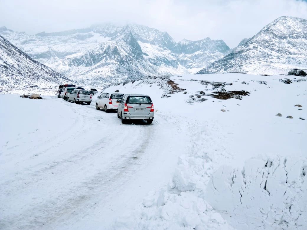
Arrive before 9 a.m. The lake is glass-still at dawn and choppy by mid-morning. In spring the snow-cut walls flanking the road make a strong wide-angle frame with a vehicle for scale.
Local travel tips
Do not linger more than 30–40 minutes on your first crossing. Altitude here is genuine; drink water, skip alcohol the night before, and keep the descent to Jang moving.
How to reach
Drive from Dirang on NH-13. The all-weather Sela Tunnel now bypasses the top; when weather allows we still take the old road over the pass itself.
The pass everything else depends on
Sela Pass at 4,170 metres is the gate to Tawang. There is no alternative road. Whatever your itinerary says, whatever you have paid, if Sela is shut you are not going to Tawang that day — which is why every honest Tawang tour package is built with the pass in mind rather than as a photo stop along the way.
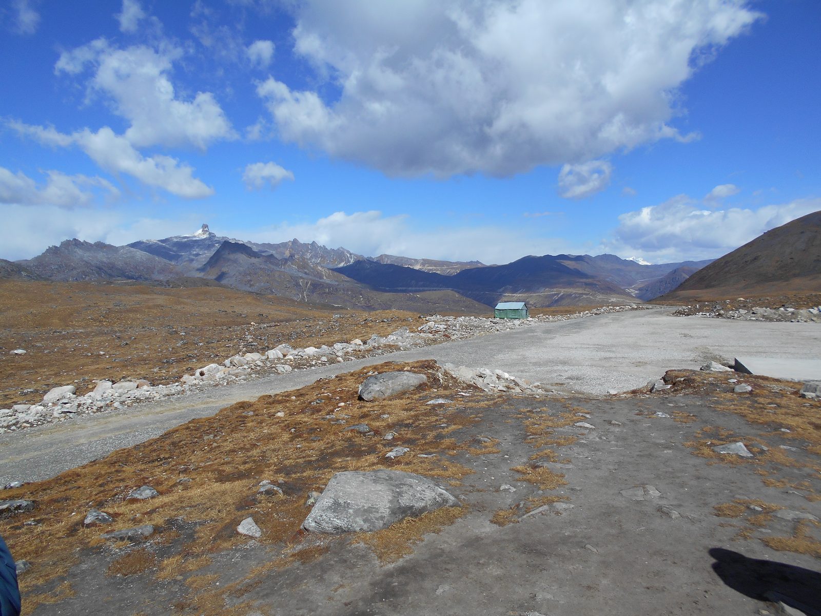
It is also, on a clear morning, one of the great high-road experiences in India: a long climb out of the Dirang valley through rhododendron and dwarf bamboo, a treeless bowl of scree and frozen grass near the top, and Sela Lake sitting flat and glassy beside the road just below the crest.
Sela Tunnel: what changed and what did not
The Sela Tunnel, opened in 2024, runs beneath the most exposed section of the approach. It has changed winter reliability significantly: convoys and civilian traffic can pass under the worst of the snow line instead of waiting for the top to be cleared, and journey times in bad weather are far more predictable than they were.
What it did not do is make the route weather-proof. The approach roads on both sides still gather snow, and heavy falls still stop traffic. It also created a small planning question for travellers: taking the tunnel is faster, but it means missing the pass itself. On a good-weather day we drive over the top and use the tunnel on the return; in bad weather we take the tunnel both ways without apology.
Road conditions month by month
| Months | Snow | Typical status | What to expect at the top |
|---|---|---|---|
| December–February | Heavy | Intermittent closures; tunnel often the only option | Sub-zero, wind, banked snow walls, frozen lake |
| March–April | Residual | Open, occasional overnight falls | Snow banks beside a clear road, cold and bright |
| May–June | Minimal | Reliably open | Rhododendron on the approach, best all-round month |
| July–September | None | Open but landslide risk below Dirang | Cloud, drizzle, low visibility at the crest |
| October–November | First falls | Open, superb visibility | Coldest clear mornings of the year |
Travelling between December and March? Ask us for the itinerary with a built-in weather buffer.
Request a custom quoteStopping at Sela: how long and what to do
Forty-five minutes is the right amount of time. Longer than that at 4,170 metres, straight off a climb from 1,560 metres, and a fair number of travellers start to feel it.
In that window: the gate and the prayer flags, Sela Lake and its rim of ice, tea at the small stall that somehow operates year-round, and the short walk to the viewpoint above the road. Move deliberately. The single most common mistake here is people sprinting up the slope for a photograph and spending the next hour with a headache they blame on the food.
Twelve kilometres beyond the pass is Jaswantgarh, the memorial to Rifleman Jaswant Singh Rawat, where the Army serves tea and the story is told properly. It is worth twenty minutes even if military history is not your interest.
Photographing Sela
The light is difficult and the conditions are hostile to equipment, so plan rather than improvise. Early morning gives you the flattest water on the lake and the least cloud on the ridges; by eleven the cloud has usually built from the Tawang side. In snow months, expose deliberately over the meter reading or everything comes back grey.
Batteries die fast in the cold — keep spares in an inside pocket. Lens changes at the pass are a bad idea in wind carrying grit and ice. A polariser earns its place here more than almost anywhere else on the circuit, both for the lake and for the sky above the scree.
Where Sela sits in a Tawang itinerary
Sela is crossed twice: once going up on day two or three, once coming down. It is never a destination in its own right, which is exactly why travellers underestimate it. Both the 5 nights / 6 days and the 6 nights / 7 days itineraries cross it, and the seven-day version is the one that can absorb a closure.
The nearest overnight options are Dirang below and Tawang above. Sleeping at the pass is not an option, and attempting to cross it after dark is something no responsible operator will agree to.
Send your travel month and we will tell you how likely Sela is to cooperate.
Request a custom quoteThe history of the pass and the 1962 road
Sela was a herders' and traders' crossing long before it was a road. The Monpa moved salt, wool and butter over this saddle between the Dirang valley and the Tawang bowl, and the pass carried pilgrims to the monastery for three centuries before a vehicle ever reached the top.
The modern road exists because of the 1962 Sino-Indian war. Rifleman Jaswant Singh Rawat of the 4th Garhwal Rifles held the approach at Nuranang for three days in November 1962; the memorial at Jaswantgarh, twelve kilometres beyond the pass on the Tawang side, is maintained by the Army and every serving unit still treats him as on-duty. The Border Roads Organisation has kept the pass open since, and BRO signboards — the ones travellers photograph for their deadpan safety rhymes — are the only reason a civilian Innova gets over 4,170 metres in February.
The Sela Tunnel, inaugurated in March 2024, is the latest chapter: twin tubes beneath the worst of the approach, built for all-weather military access and used by every civilian vehicle when the top is closed.
Sela Pass compared with the other high points on the circuit
The practical reading of that table: Sela is the only high point on the circuit that everyone, including foreign passport holders, is generally able to see, subject to the pass being open. Everything above it depends on paperwork and on the Army's mood that morning, which is why access to Bumla is never sold as a certainty.
| Place | Altitude | Permit | Open to foreign nationals | Time from Tawang |
|---|---|---|---|---|
| Sela Pass | 4,170 m | ILP / PAP only | Yes | 2 h 45 m |
| Bumla Pass | 4,633 m | ILP + DC and Army clearance | No | 2 h 30 m |
| Sangetsar (Madhuri) Lake | 3,708 m | Same as Bumla | No | 2 h |
| PTSo Lake | 3,900 m | Same as Bumla | No | 1 h 30 m |
| Tawang Monastery ridge | 3,048 m | ILP / PAP only | Yes | 10 minutes |
Local tips for the crossing
Eat something before the climb from Dirang and keep it light. The combination of switchbacks, altitude and a heavy breakfast accounts for most of the discomfort travellers blame on the mountain.
Fill fuel at Dirang or Tawang, never assume anything between. Carry cash: the tea stall and the small shops at the gate take nothing else, and mobile signal is unreliable from the last village below the pass until you drop towards Jang.
Layer rather than bulk. You will step out of a warm vehicle into wind at 4,170 metres and back in again twenty minutes later; a jacket you can open matters more than the thickest one you own. Sunglasses are not optional in snow months — glare at this altitude burns eyes faster than people expect.
If your driver says the top is closing, believe him and turn around. The tunnel is there for exactly this, and no photograph is worth being caught above the snow line at dusk.
Travelling with children or elderly parents? Ask us for the slower Sela crossing with an extra acclimatisation night at Dirang.
Request a custom quoteWhat to see within an hour of the pass
Read the Nuranang Falls and Dirang guides next if you are shaping the driving days, and the Tawang weather-by-month guide if you are still choosing dates. The Guwahati to Tawang road trip guide covers the full 520-kilometre drive of which Sela is the crux.
| Stop | Side | Distance from Sela | Why stop |
|---|---|---|---|
| Sela Lake (Paradise Lake) | At the pass | 0.5 km | Frozen in winter, mirror-flat in autumn |
| Jaswantgarh War Memorial | Tawang side | 12 km | Army-run memorial and free tea |
| Nuranang (Jang) Falls | Tawang side | 45 km | 100 m waterfall, strongest in monsoon |
| Sangti Valley | Dirang side | 75 km | Black-necked crane wintering ground |
| Mandala Top, Dirang | Dirang side | 80 km | 108 stupas and the Himalayan skyline |
Plan the trip
Tawang itineraries that cross Sela Pass
Sela is not a standalone trip — every Guwahati–Tawang circuit we run crosses it on the way up and again coming down. These are the itineraries it sits inside.
The calculator is a planning tool, not a booking form — it gives an indicative budget by group size, nights and hotel category before you ask us for a quote.
Sela Pass: photographs
Photographs of this route, with the source credited beneath each frame.
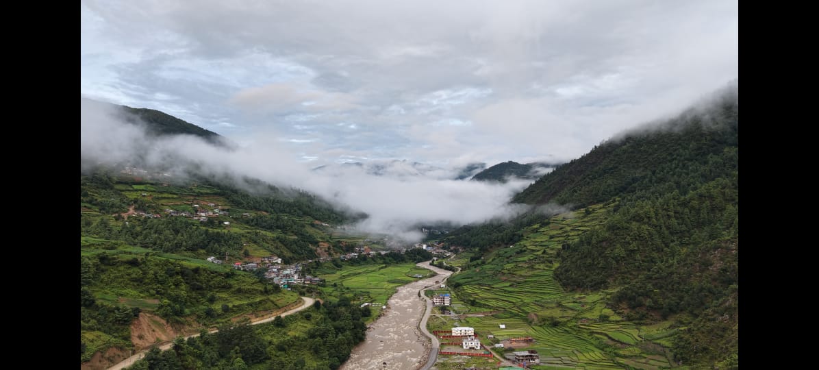
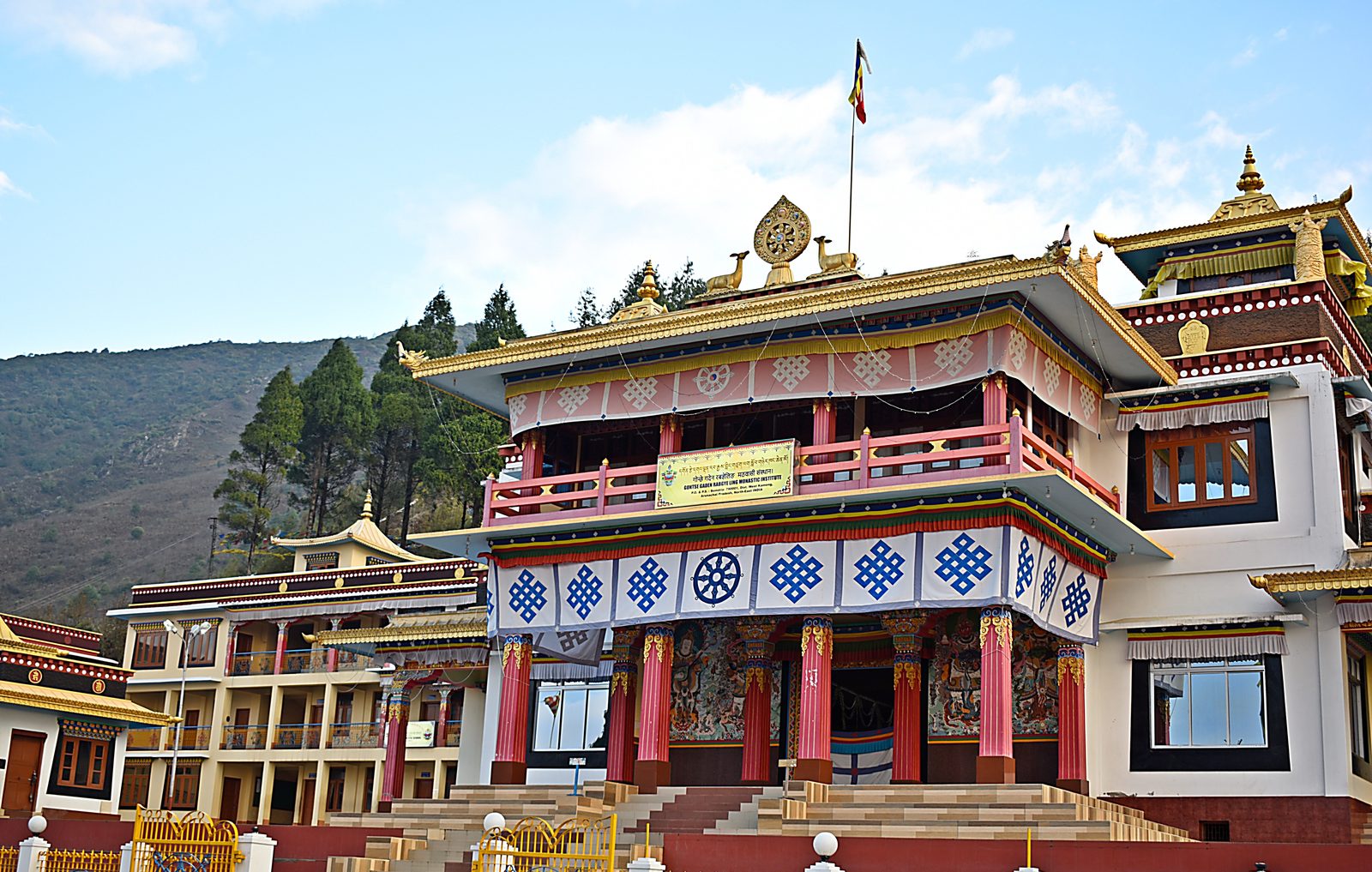
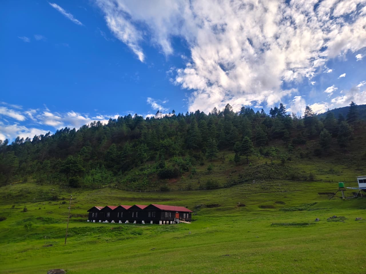
Sela Pass in deep winter — vehicles move nose-to-tail along a single BRO-cleared lane at 4,170 m.Sela Pass, West Kameng, Arunachal Pradesh · Photo: Living Roots Tours & Adventure Sela Lake (Paradise Lake) freezing over beside the pass road — clear-sky mornings follow most snowfalls.Sela Lake, near Sela Pass · Photo: Living Roots Tours & Adventure The approach to Sela — fog owns this stretch for much of the year.Sela Pass approach road · Photo: Living Roots Tours & Adventure Jaswantgarh, where the Army still serves tea to every passing traveller.Between Sela Pass and Jang · Photo: Living Roots Tours & Adventure
Location map
Nearby attractions
Recommended itineraries
- 5 Nights / 6 Days Tawang TourThe compact circuit — Sela, Tawang Monastery, Bumla and Sangetsar with no spare day.
- 6 Nights / 7 Days Tawang TourAdds a Nameri/Bhalukpong area route break on day one, with three nights in Tawang and a Bomdila night.
- Tawang Tour PackageThe planning hub: durations compared, inclusions, permits, vehicles and stays.
- Luxury Tawang ToursPremium stays, private vehicles and a slower pace on the same route.
Sela Pass: frequently asked questions
- Is Sela Pass open in winter?
- Usually, with interruptions. Heavy snowfall between December and February can shut the top for hours or days, though the Sela Tunnel has made the route far more reliable than it used to be. Winter travellers should build a spare day into the plan.
- Do I need a permit for Sela Pass?
- Only the Inner Line Permit that covers all of Arunachal Pradesh for Indian nationals, or a Protected Area Permit for foreign nationals. Unlike Bumla, Sela needs no separate District Commissioner or Army clearance, and foreign travellers can cross it.
- How long does it take to drive from Dirang to Sela Pass?
- About 62 kilometres and two and a quarter hours in good conditions. Add half an hour or more in snow, and factor in that the descent to Tawang from the pass is another 78 kilometres and roughly two and three-quarter hours.
- Will I get altitude sickness at Sela Pass?
- Mild symptoms are common — breathlessness, a light headache — because you climb 2,600 metres in a few hours. They usually clear on the descent to Tawang. Keep the stop under an hour, walk slowly and drink water.
- Should we take the Sela Tunnel or drive over the pass?
- Over the top in clear weather, through the tunnel in bad. We usually do one of each so you see the pass without gambling the whole day on it.
- Is Sela Lake frozen when we visit?
- Partially or fully from roughly late December to March, depending on the year. In May and October it is open water with ice only at the edges in the early morning.
Who wrote this
Living Roots Tours & Adventure
Living Roots Tours & Adventure is a Northeast India-based ground operator organising customised Tawang and Arunachal Pradesh journeys from Guwahati. Vehicles, local services, guides and accommodation are arranged according to the itinerary, group size and travel conditions. Where something is uncertain — a pass, a clearance, a season — we say so rather than smoothing it over.
- Base
- Northeast India — trips planned and operated from Guwahati, Assam
- Vehicles
- Experienced hill drivers and suitable vehicles arranged for the complete route
- Phone / WhatsApp
- +91 60019 80680
- dmclivingroots@gmail.com
Keep planning
Where to go next on this site
Tawang packages
- Tawang tour packageMain planning page — routes, permits, inclusions
- 5 nights / 6 days Tawang packageThe compact Guwahati–Tawang run
- 6 nights / 7 days Tawang packageBest balance of pace and weather margin
- Luxury Tawang toursPremium stays and private vehicles
- Tawang group toursSmall-group journeys arranged when a suitable group is confirmed
- Tawang fixed departuresContact us for the next confirmed small-group departure
Travel guides
- Bumla Pass guide
- Best time to visit Tawang in winter
- Tawang snowfall month by month
- Guwahati to Tawang road trip
- Tawang permits, ILP and travel basics
- Sangti Valley guide
- Mago Valley guide
- Thembang village guide
- Best time to visit Tawang
- Tawang weather by month
- Tawang packing list
- Tawang trip budget guide
- Inner Line Permit: how to apply
- Bumla Pass permit process
- Tawang with family and kids
- Tawang honeymoon guide
- Tawang photography guide
- Tawang food guide
- Monpa culture guide
- Tawang festivals and Torgya
- Dirang travel guide
- Bomdila travel guide
- Tawang FAQs
- Shergaon travel guide
- Zemithang travel guide
- Mukto village guide
- Mandala Top guide
- Luxury Tawang travel guide
Planning the whole trip rather than one stop? Start with our Tawang tour package page — it covers routes, permits, seasons, stays and how a Tawang trip is quoted.