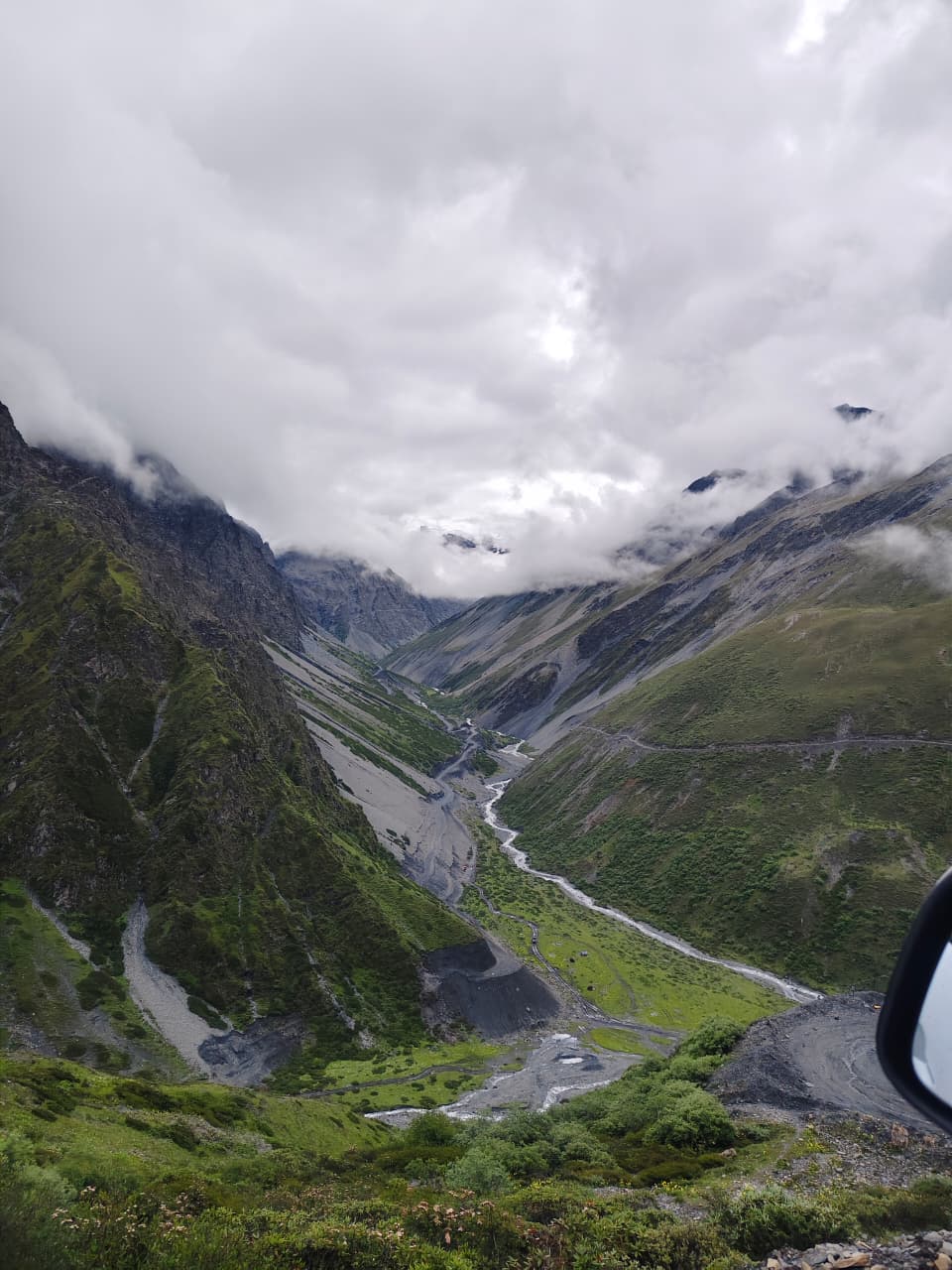
How to reach Mago Valley from Tawang: permission, road condition, altitude, Brokpa yak-herding culture and what to expect from a village with no network or fuel.
History
Mago is a Brokpa yak-herding settlement whose grazing rights predate every modern boundary in this corner of the Himalaya. Families here still move animals seasonally across pastures that touch three watersheds, and the village was only opened to civilian visitors in recent years after decades as a purely military approach.
Culture and daily life
Life is organised around the yak. Butter, chhurpi and coarse wool underpin the household economy, and the Brokpa dialect differs noticeably from Monpa spoken in Tawang town. Hospitality is genuine and unrehearsed — there is no tourism industry here, only households who agree to host you.
Photography notes
Shoot the herds in the first hour after sunrise when frost still holds the grass. A 70–200 mm lens compresses the yaks against the valley walls; wide-angle work is best reserved for the braided riverbed on the approach.
Practical travel tips
Carry your own sleeping bag, cash, and a full tank. There is no network, no fuel and no shop. Permission is arranged through the Tawang DC office and can take a day — we file it before you arrive.
Around 5 hours from Tawang via Jang and Thingbu on a rough army road; special permission required.
Plan the trip
Extended Tawang itineraries
Mago needs additional permits and days beyond the standard circuit; we plan it as an extension.
The calculator is a planning tool, not a booking form — it gives an indicative budget by group size, nights and hotel category before you ask us for a quote.
Mago Valley Guide: photographs
Photographs of this route, with the source credited beneath each frame.
Glacial country on the roads north of Tawang, above the treeline.North of Tawang town · Photo: Living Roots Tours & Adventure Summer grazing meadows — the Brokpa herding season runs May to September.West Kameng highlands · Photo: Living Roots Tours & Adventure Bum La Pass on the Indo-China border, 37 km north of Tawang and reachable only with an Army-countersigned permit.Bum La Pass, Tawang district, Arunachal Pradesh · Photo: Itrajib / Wikimedia Commons · CC BY-SA 4.0 Sangetsar Tso, better known as Madhuri Lake — the drowned fir trunks date from the 1950 Assam–Tibet earthquake.Sangetsar Tso, Tawang district, Arunachal Pradesh · Photo: Rohit Sharma / Wikimedia Commons · CC BY-SA 4.0
Keep planning
Where to go next on this site
Tawang packages
- Tawang tour packageMain planning page — routes, permits, inclusions
- 5 nights / 6 days Tawang packageThe compact Guwahati–Tawang run
- 6 nights / 7 days Tawang packageBest balance of pace and weather margin
- Luxury Tawang toursPremium stays and private vehicles
- Tawang group toursSmall-group journeys arranged when a suitable group is confirmed
- Tawang fixed departuresContact us for the next confirmed small-group departure
Travel guides
- Bumla Pass guide
- Best time to visit Tawang in winter
- Tawang snowfall month by month
- Guwahati to Tawang road trip
- Tawang permits, ILP and travel basics
- Sangti Valley guide
- Thembang village guide
- Best time to visit Tawang
- Tawang weather by month
- Tawang packing list
- Tawang trip budget guide
- Inner Line Permit: how to apply
- Bumla Pass permit process
- Tawang with family and kids
- Tawang honeymoon guide
- Tawang photography guide
- Tawang food guide
- Monpa culture guide
- Tawang festivals and Torgya
- Dirang travel guide
- Bomdila travel guide
- Tawang FAQs
- Shergaon travel guide
- Zemithang travel guide
- Mukto village guide
- Mandala Top guide
- Luxury Tawang travel guide
Planning the whole trip rather than one stop? Start with our Tawang tour package page — it covers routes, permits, seasons, stays and how a Tawang trip is quoted.
Plan this with us
Living Roots Tours & Adventure runs trips across Assam and Arunachal Pradesh, with experienced hill drivers and suitable vehicles arranged for the complete route. Tell us your dates and we will build the route around them.
Continue reading
- 5 Nights / 6 Days Tawang Tour5 nights 6 days Tawang tour itinerary from Guwahati: Dirang, Sela Pass, Tawang Monastery, Bumla Pass and Sangetsar Lake. Request a custom quote.
- 6 Nights / 7 Days Tawang Tour6 nights 7 days Tawang tour itinerary ex-Guwahati via Nameri/Bhalukpong, Dirang, Sela Pass, Bumla, Sangetsar and Tawang Monastery. Custom quote on request.
- 7 Nights / 8 Days Tawang TourA slower 7-night, 8-day Tawang circuit from Guwahati via Nameri/Bhalukpong, Dirang and Bomdila, with three nights in Tawang. Custom quote on request.
- Tawang Tour Packages from GuwahatiTawang tour packages: 6 to 11 day itineraries ex-Guwahati, permits, inclusions and the right season to travel. Request a custom quote.
- Luxury Tawang ToursPremium Tawang tours: comfortable stays, private Fortuner or Innova Crysta vehicles and guides arranged according to the itinerary.
- Tawang Group ToursSmall-group Tawang tours arranged for friends, couples and first-time visitors travelling together. Enquire for current group possibilities.